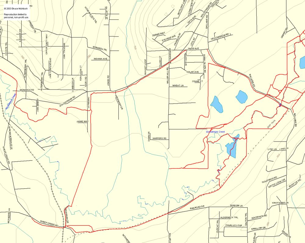
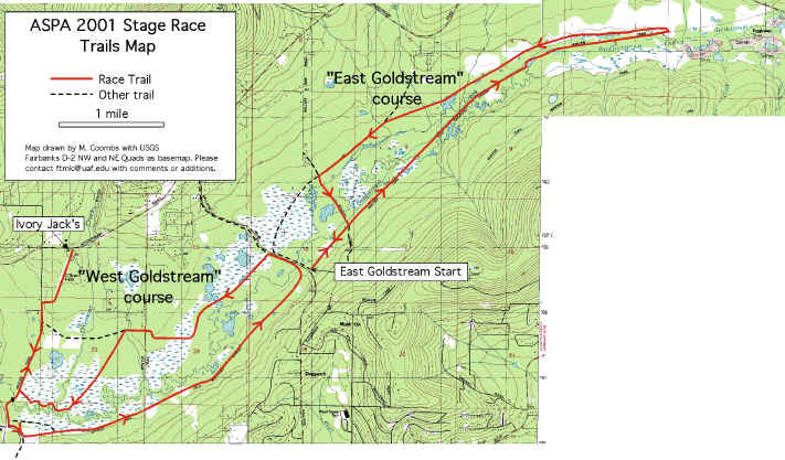
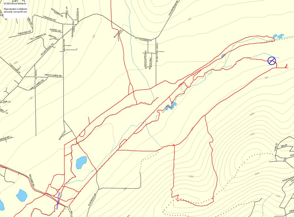
Here are some maps of the trails in the Goldstream Valley, on the north side of Fairbanks. These maps are pretty old, but give you an idea of what is there. Not all trails are shown, but this is a fairly comprehensive inventory of the main trails regularly used by skiers, mushers, and bikers in Goldstream Valley. Note that many of these trails (particularly west of Ballaine Road) cross over private property and, although the boundaries are rarely posted on the ground, be respectful wherever you are.
Large areas of the valley are managed by the Interior Alaska Land Trust, and you can find information about their land and activities here (and while you’re there, you might consider making a donation to help them with their incredible work keeping land around Fairbanks available to us all). They also have a map on that page of the combined IALT and state DNR lands.
Just as important – be aware that you’re likely to encounter a variety of users. You may meet up with a lone biker followed a minute later by someone driving a big string of dogs. Many sections of trail are maintained by local mushers – that nicely groomed and brushed trail means that the odds of running into a dogteam in training go way up. These folks put alot of sweat (and money) into keeping things in shape. Please practice good trail manners.
Huge thanks to Bruce McIntosh for letting us use parts of pages that he set up years ago; you can see his original work here. Your work lives on, Bruce.
ASPA 2001 Stage Race Map
Trails East of Ballaine Road
(Note: the eastern end of these trails is affected by mining activity outside of Fox, so be careful when you venture out that way.)
Trails West of Ballaine Road